TRANS-ALASKA PIPELINE SYSTEM: MEGA-INFRASTRUCTURE ON UNSTABLE GROUND

Presented at the American Society of Landscape Architects annual meeting, Denver, November, 2014

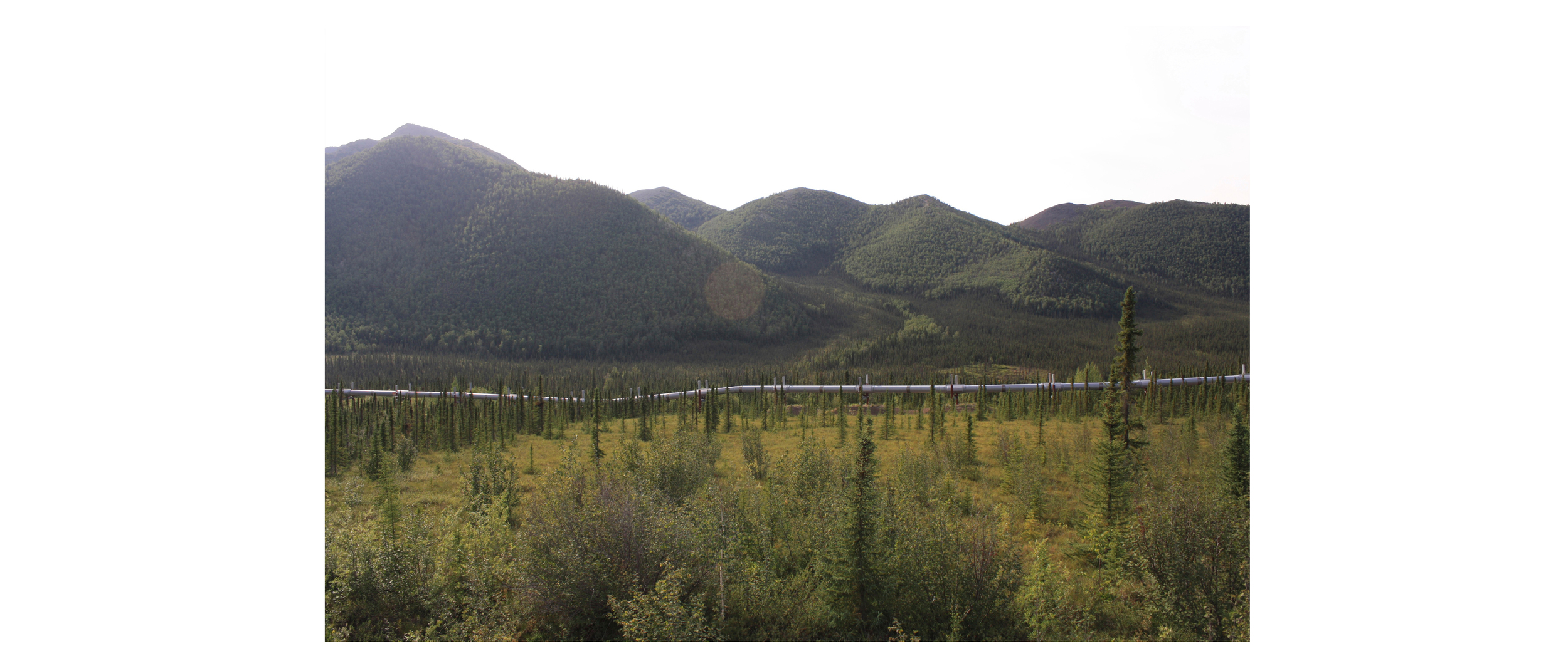
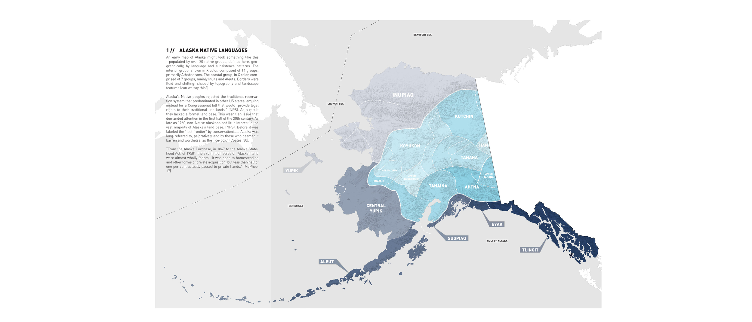
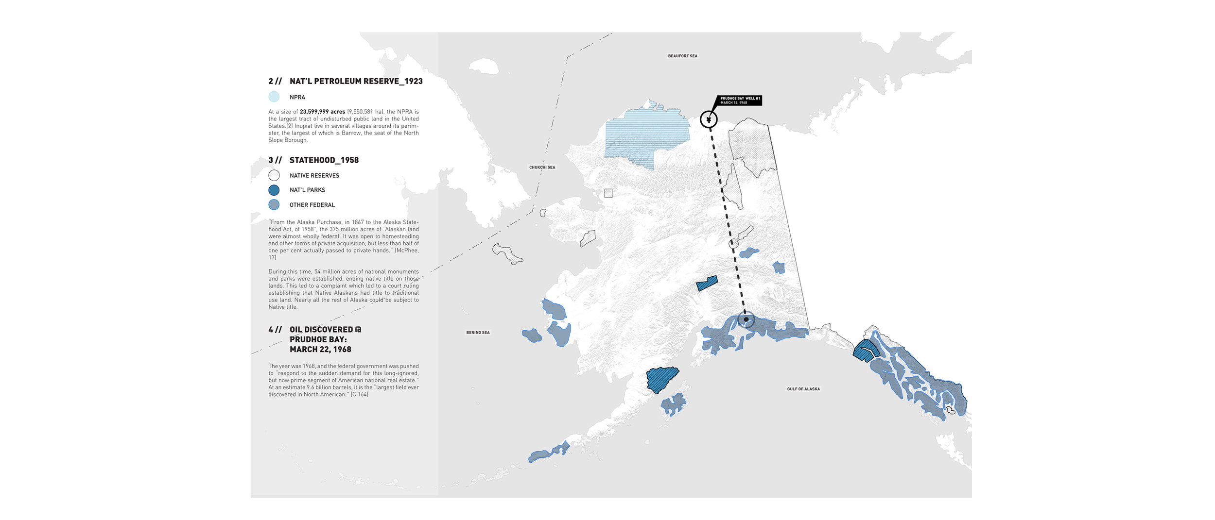
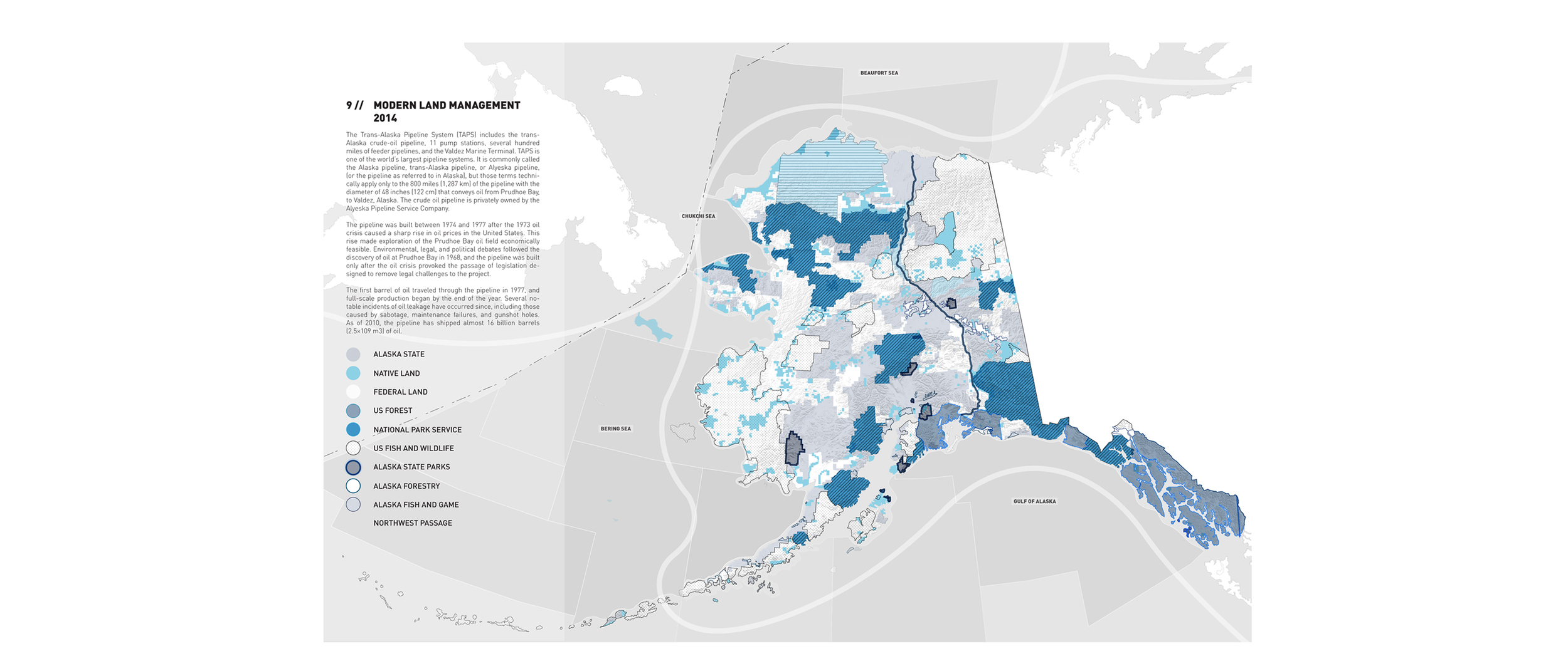
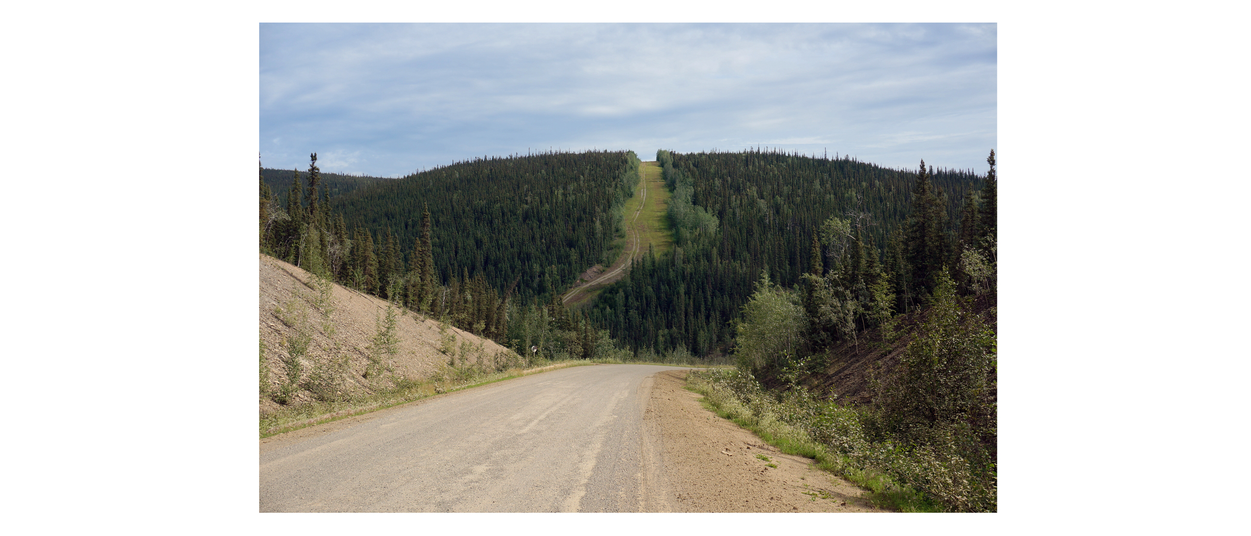
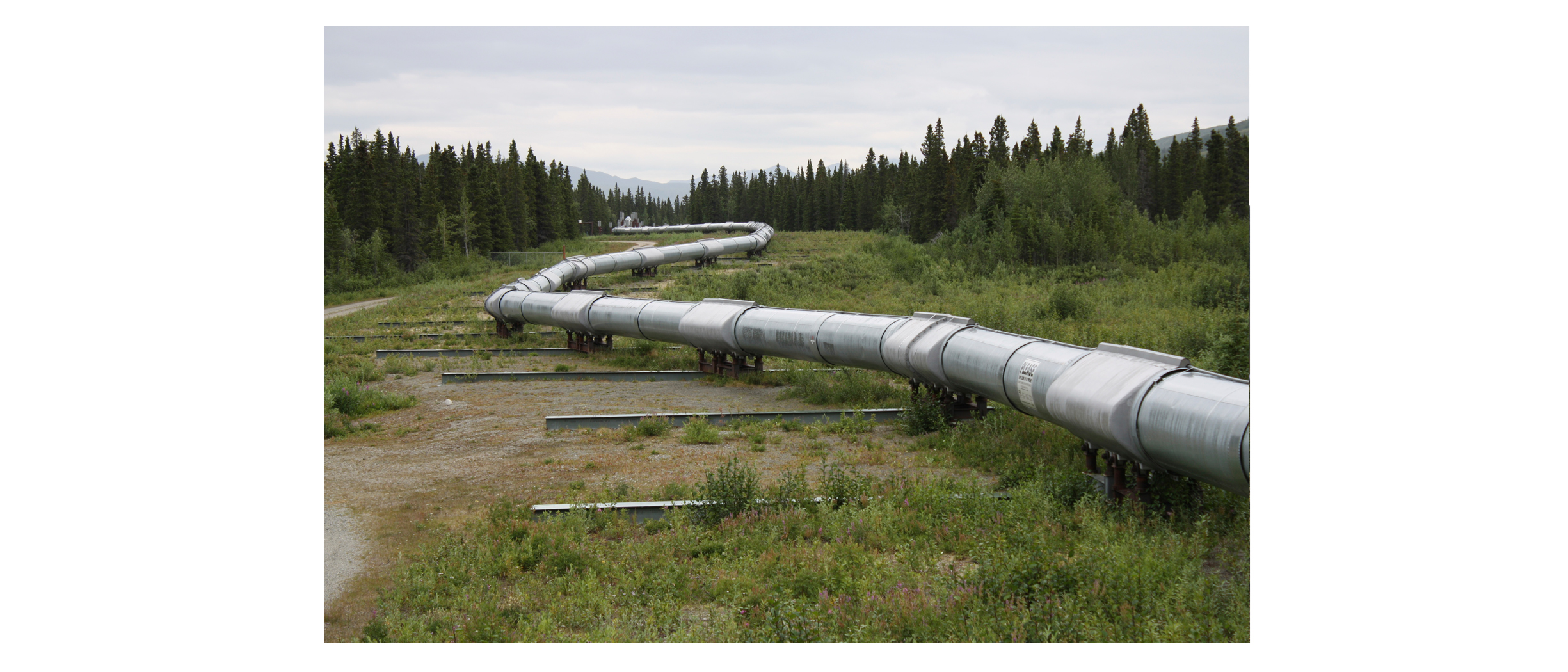
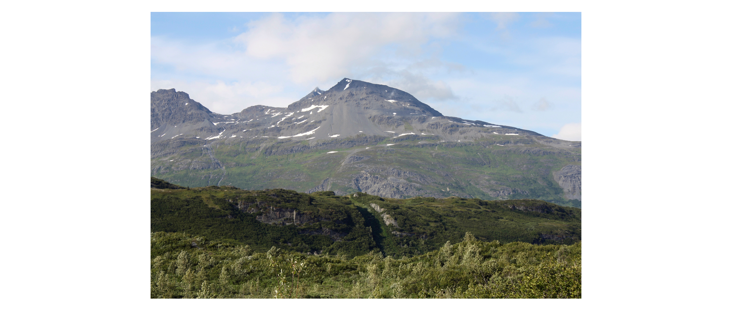
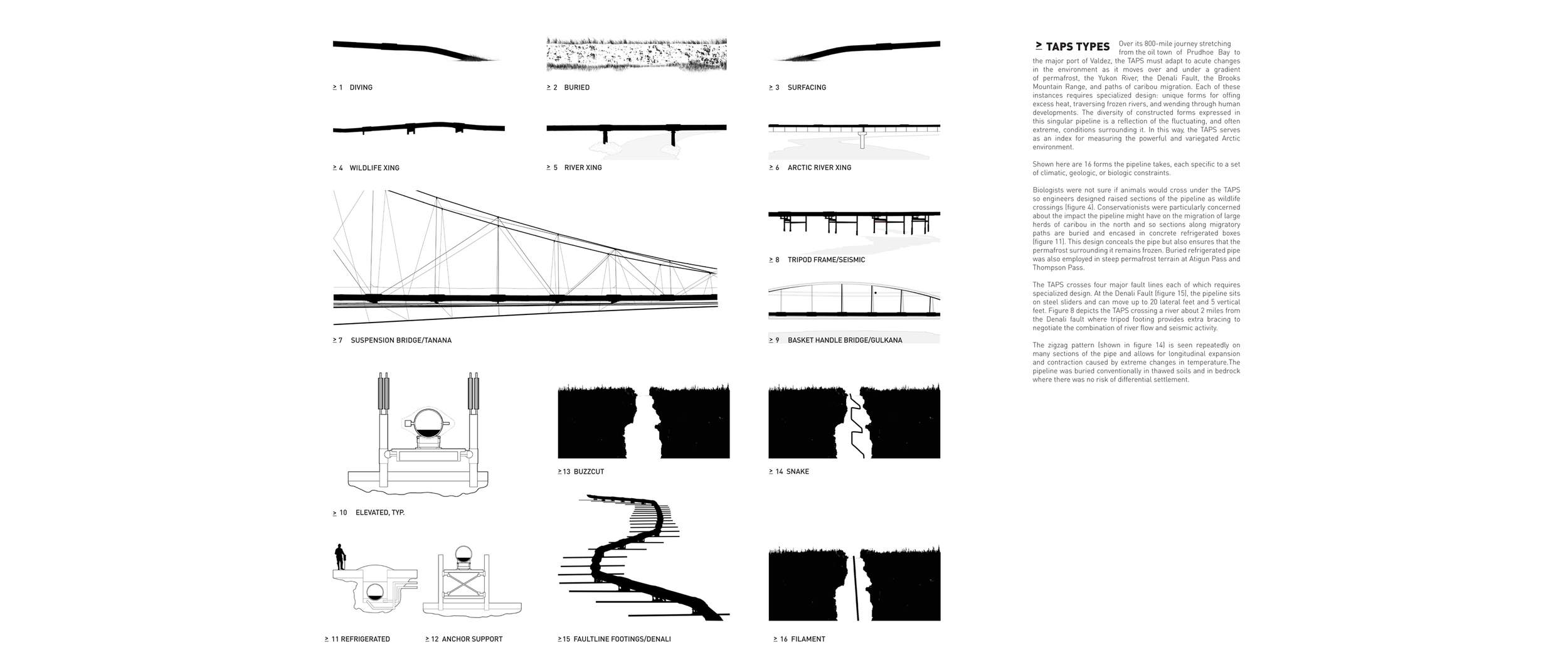
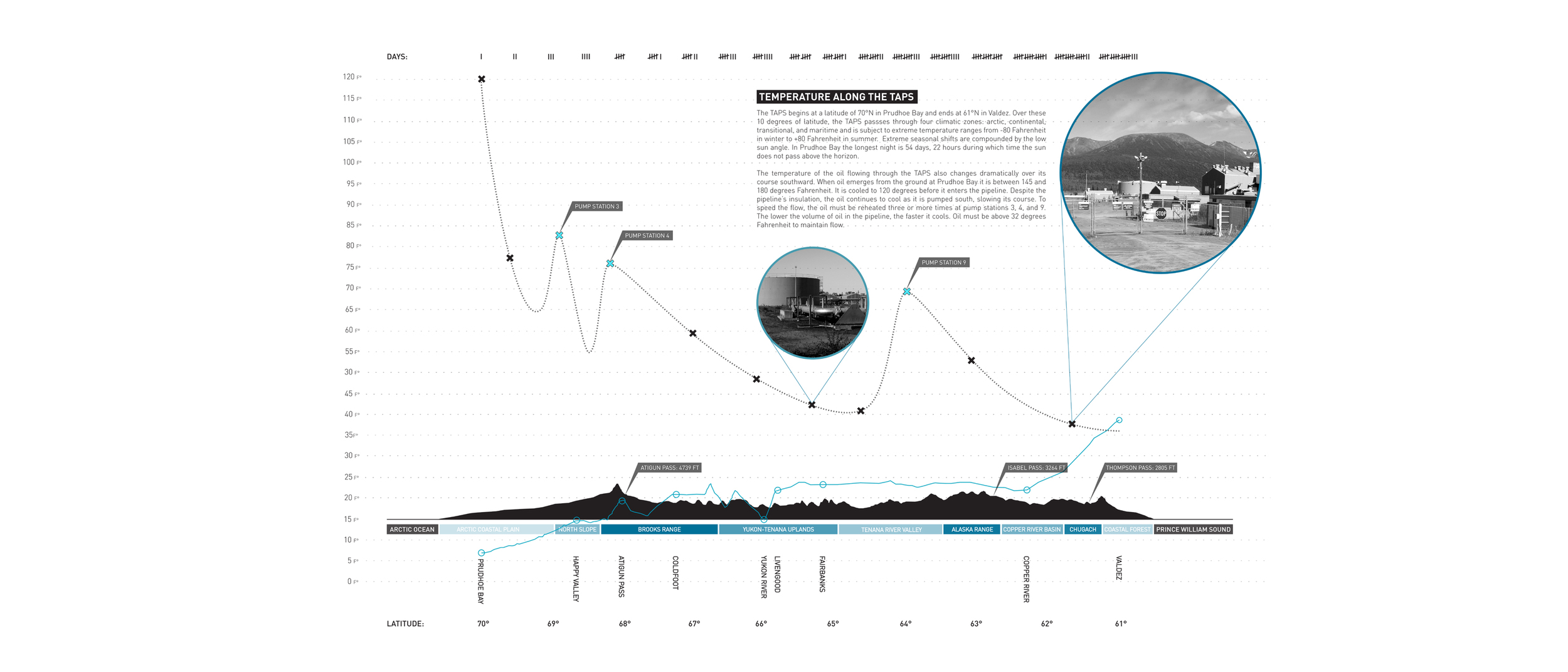
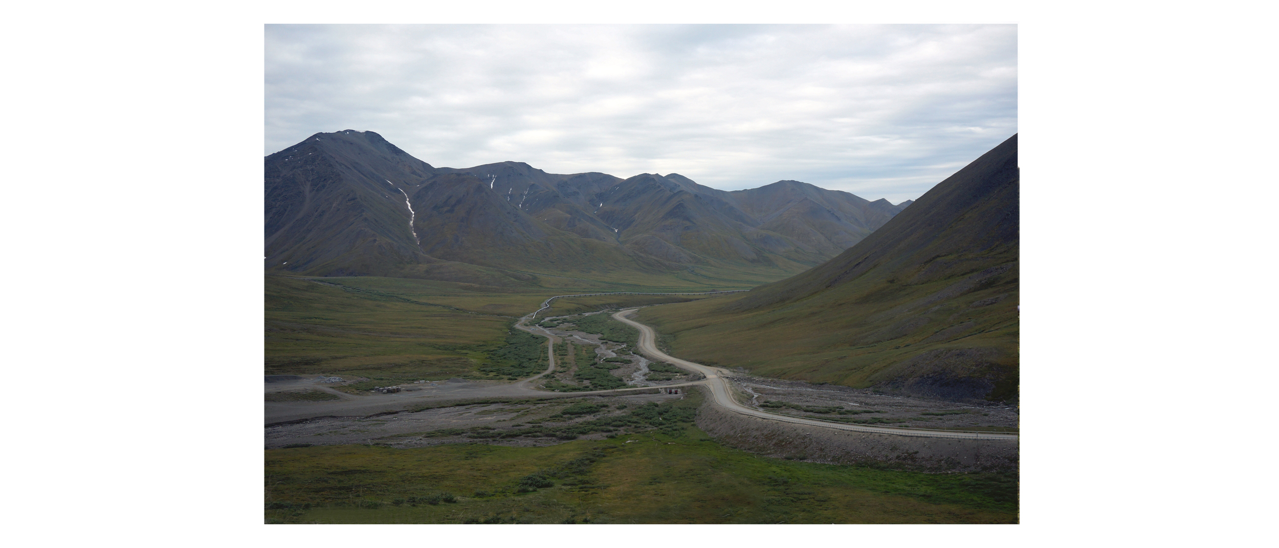
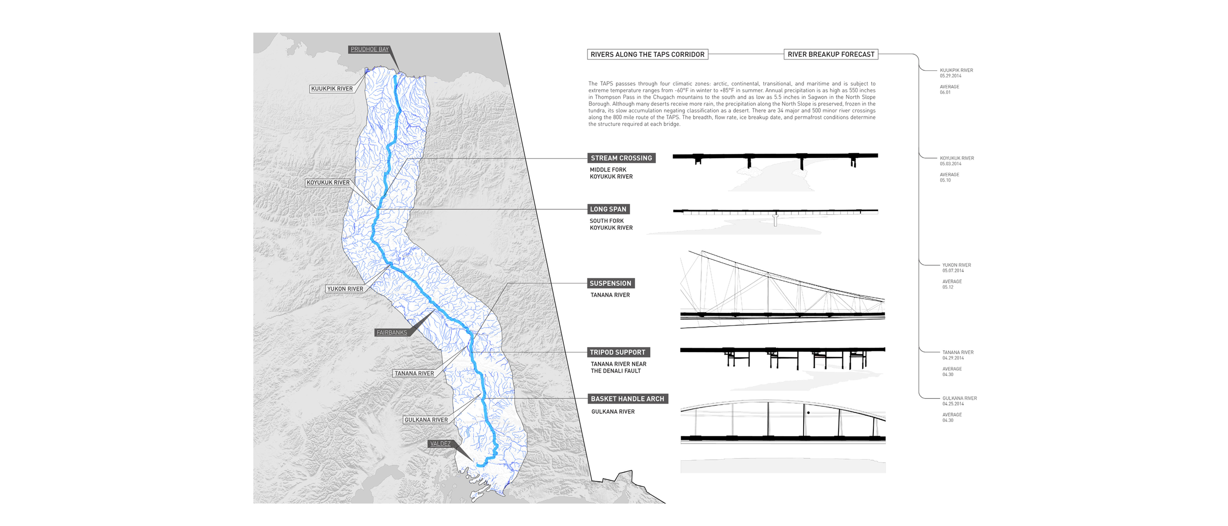
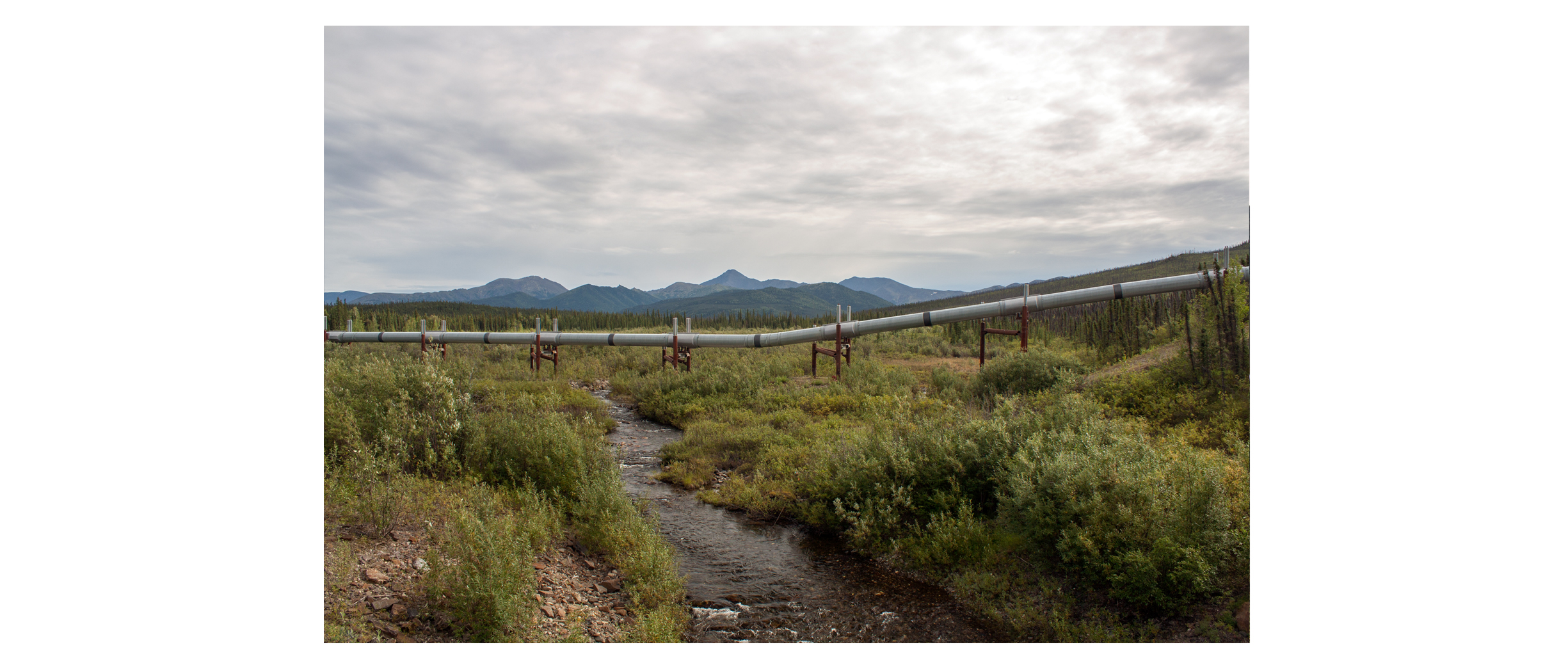
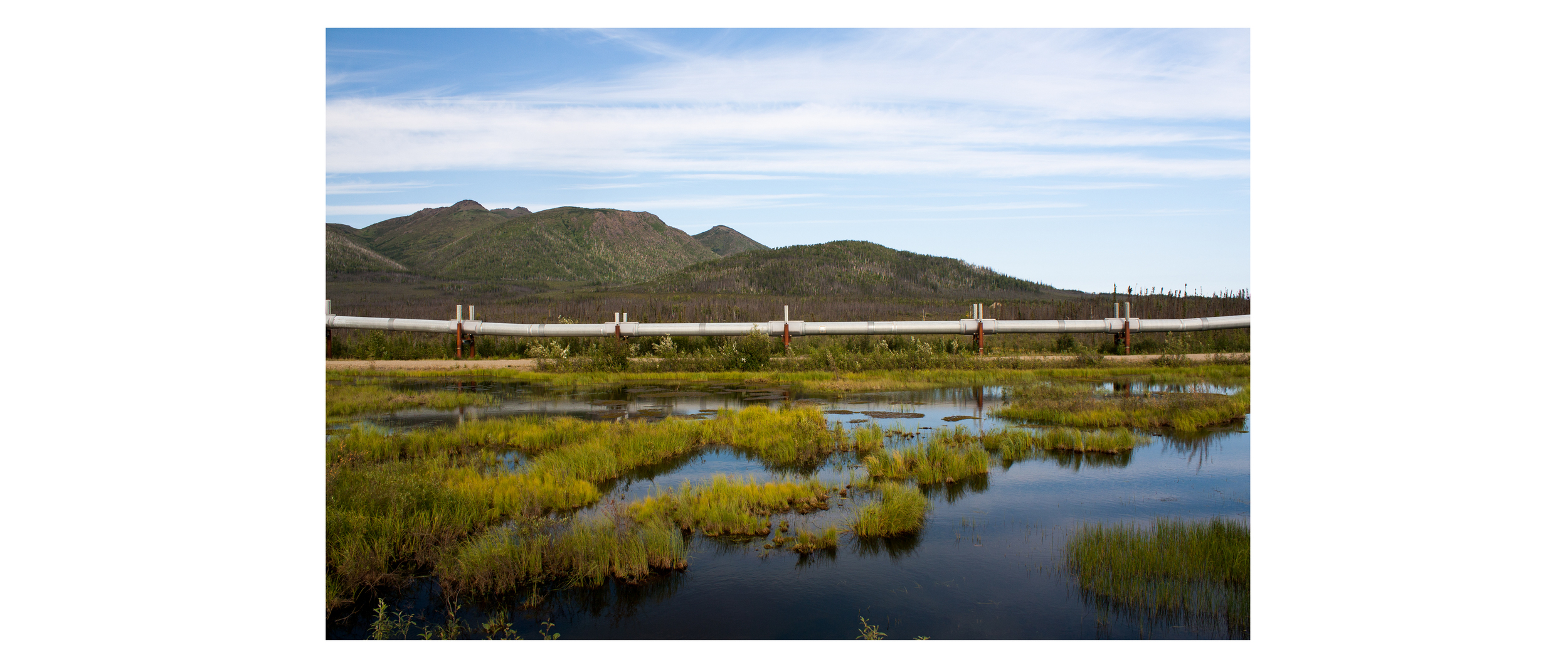
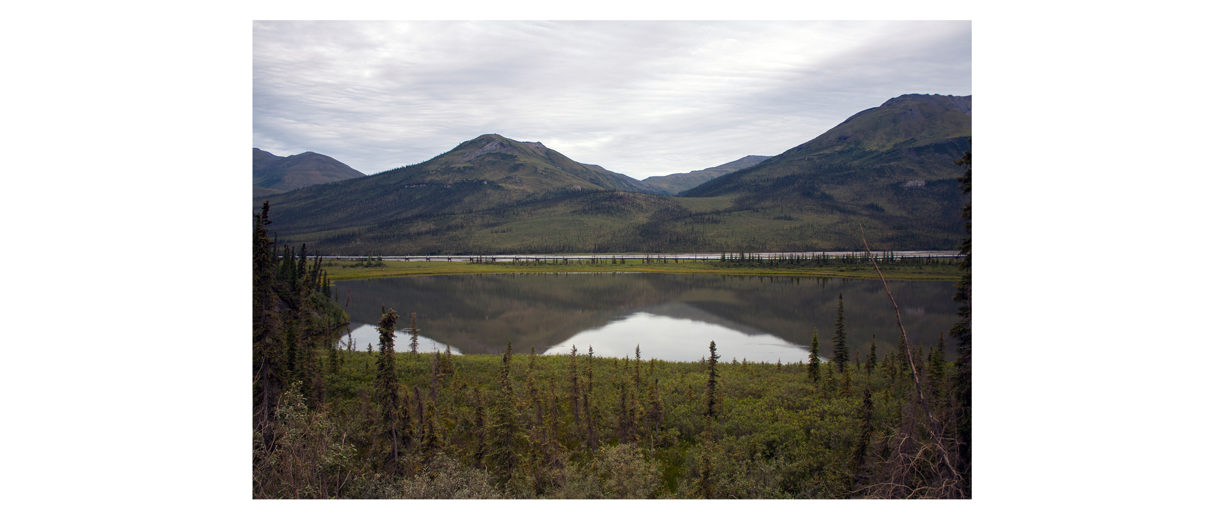
The rapidly transforming Arctic landscape of Alaska is host to an extraordinary coupling of mega-infrastructure and shifting terrain. The Trans-Alaska Pipeline System (TAPS), an 800-mile seam stretching from the oil town of Prudhoe Bay to the major port of Valdez, Alaska, must adapt to acute changes in the environment as it moves over and under a gradient of permafrost, the Yukon River, the Denali Fault, the Brooks Mountain Range, and paths of caribou migration.  

Each of these instances requires specialized design: unique forms for offing excess heat, traversing frozen rivers, and negotiating seismic zones. The diversity of constructed forms expressed in this singular pipeline is a reflection of the fluctuating, and often severe, conditions surrounding it. In this way, the TAPS serves a second function as an index for measuring the powerful and variegated Arctic environment.

Here, in some of the most remote country in the United States, the adjacent pressures of resource extraction, development, and environmental preservation in the face of climate change are made stark, distilled along a single line. 


The architecture of the Trans-Alaska Pipeline System is superhuman in scale – 800 miles in length in addition to hundreds more miles of feeder pipeline. Unlike most pipelines, which are concealed beneath the ground, the 120 degree Fahrenheit oil flowing through the TAPS would melt the ice-rich Alaskan permafrost if buried, leading the pipe to rupture. Thus, for 420 miles of its journey, the pipeline rides above the ground on 78,000 vertical supports. Its distinct presence in the landscape complicates its relationship to the surrounding habitat, but also provides coincident opportunities for documentation and revelation. 

The form of resource extraction and transportation typified by the Trans-Alaska Pipeline System is unique to an era of petrochemical industrialization. Its coexistence with the Alaskan tundra is finite. The Arctic is warming at twice the rate of the rest of the globe, such that by the year 2100, a warmer atmosphere is predicted to push the edge of Alaskan permafrost northward over 300 miles, divorcing the specialized designs of the TAPS from its environment. In this way, the landscape along the TAPS is a landscape of irony - the oil drilled and transported through Alaska’s fragile permafrost terrain, is, in fact, fueling its transformation. 

In August of 2014 we traveled to Alaska to study the distinct architectural typologies of the Trans-Alaska Pipeline System as it responds to surrounding ecologies, warming atmospheres, and emergent conditions.